We designed the MapTiler Desktop to be the most user-friendly geodata processing tool. For the upcoming version, we are asking you, the community of users, to give us your feedback.
The vision
Since the very beginning, MapTiler Desktop was created to help turn files into zoomable maps. The simple user interface allows everyone, even creative people with no technical background, to process anything you drop into it - and create map layers and overlays on existing world maps.
Being the most user-friendly geodata processing tool for converting maps-data into a web and mobile-ready form.
Assigning location information to images or plans was always easy - with visual georeferencing - or powerful with other methods available for power users. Raster tiles were recently complemented with vector tiles rendering functionality.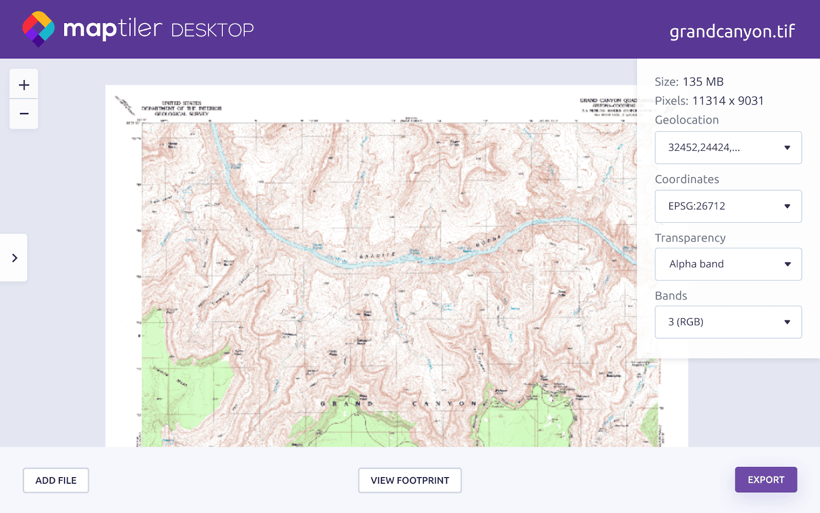 This all is the “good old stuff” we want to keep and improve. But what should be added next?
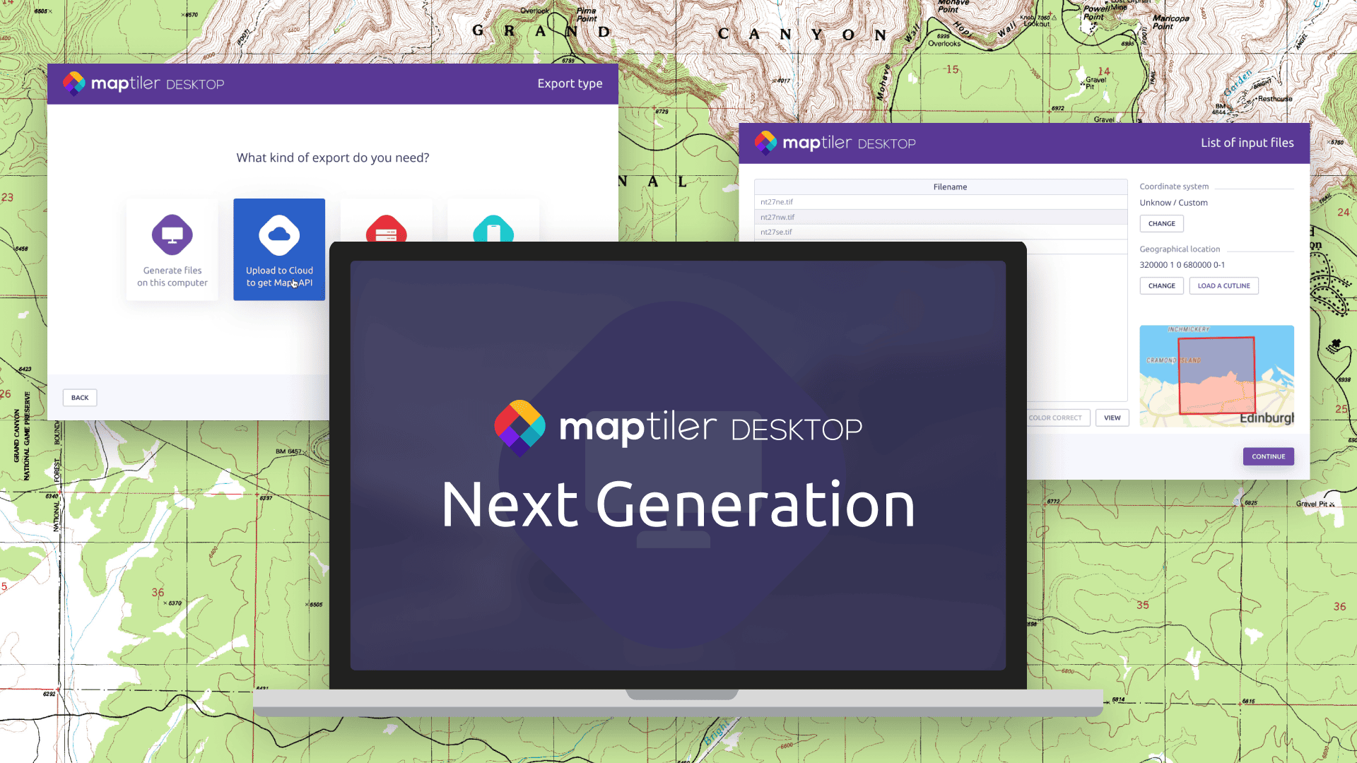
Make MapTiler Desktop more visual & interactive
One of the biggest news will be an ability to preview geodata files on your computer before you start to render.
Any kind of data can be viewed, including raster TIFF/GeoTIFF, MrSID, ECW, JPEG2000/GeoJP2, Erdas HFA, NOAA BSB/KAP, Ozi Explorer OZF2/OZFx3, JPEG, GIF, PNG, TIFF with RGB color model, or vector GeoPDF, ESRI Shapefile, GeoJSON, GeoPackage, KML, and GPX.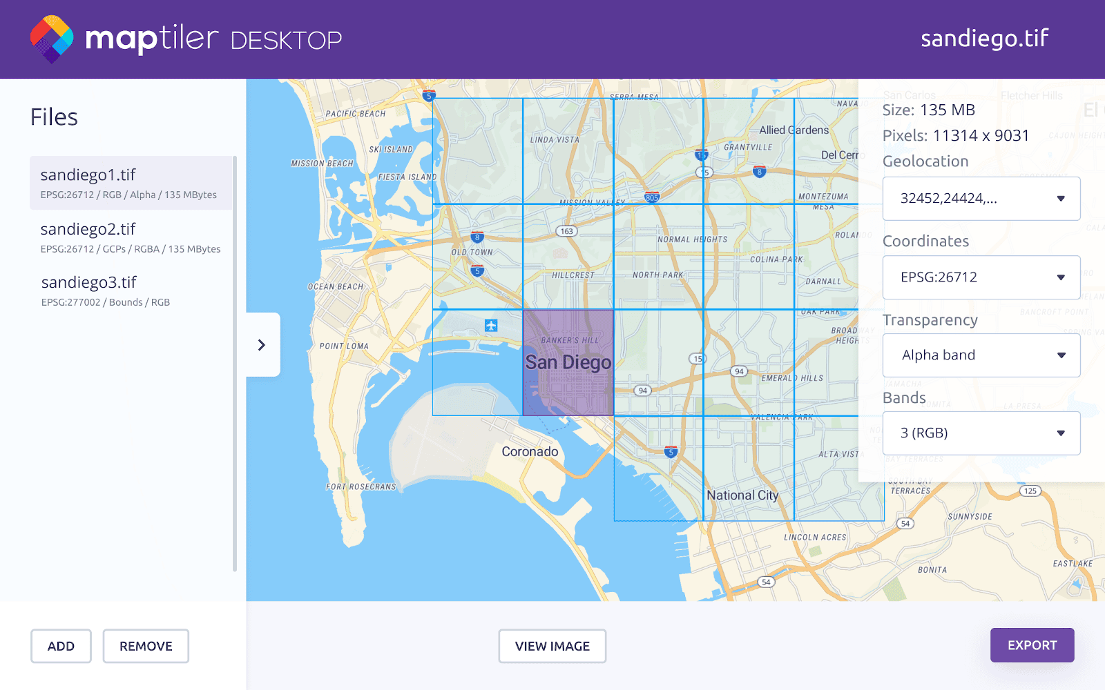 The new version of MapTiler Desktop will also allow preview input files before rendering.
Interaction redesigned from the ground-up
The most visible improvement will be the brand new UI. The idea is to keep the simplicity and preserve workflows you are used to. We welcome your feedback on the functionality you are using the most - to make it even more visible.
All design elements, including icons, will be unified to respect the look&feel of our website and other products.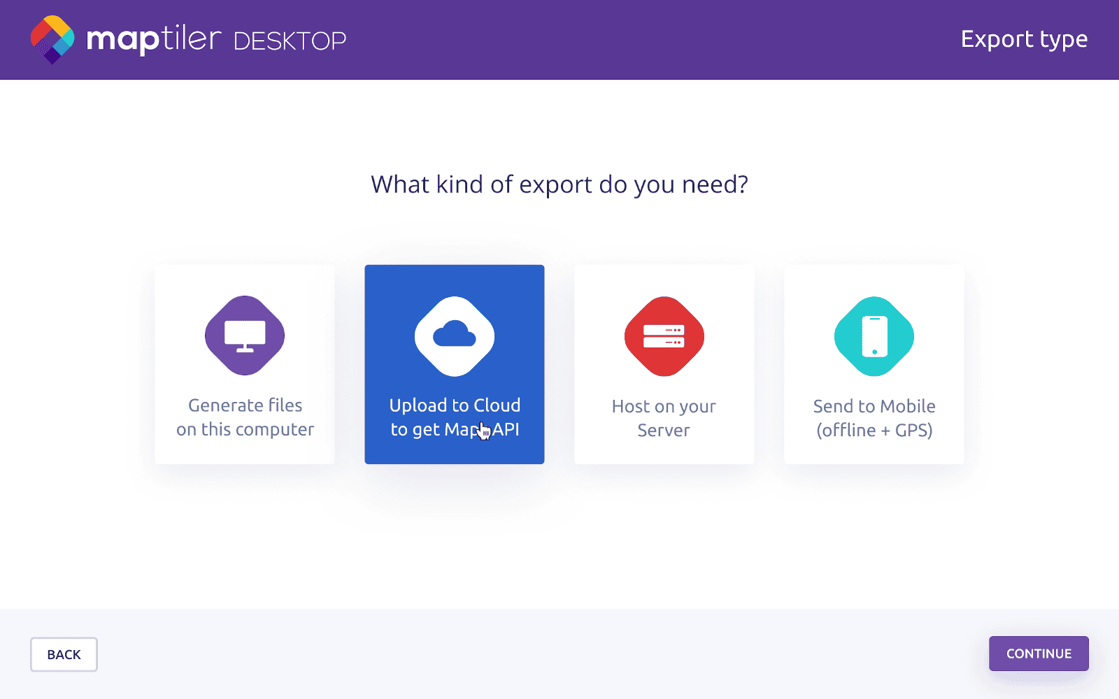
Brand new UX for vector tiles rendering
Rendering of vector tiles, which was added quite recently, will get a brand new well-thought-out interface. This UX will be started from scratch and allow much more functionality.
New dialogs for the main functionality
The navigation will be more clear because each step of the rendering wizard will have its name displayed in the top right corner.
Together with the navigation, the terminology will be adjusted, e.g. input files vs output files, input coordinate system vs output coordinate system, …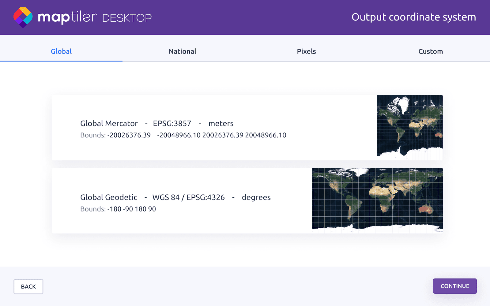
Powered by new components
The upcoming version of MapTiler Desktop will use the latest system components.
The graphical user interface will be written in Qt5, which uses a faster WebKit rendering engine. The newest WebKit also allows visual georeferencing using any modern web map service, including Google Maps.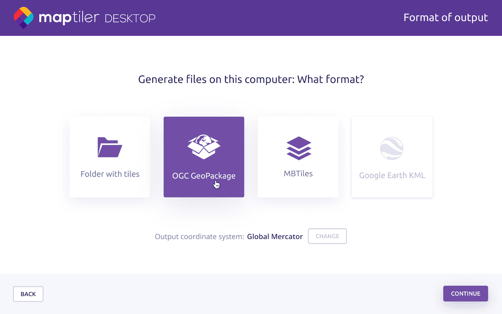 Qt5 adds new possibilities and is available on all modern systems, including Windows 10, macOS 10.15, and Ubuntu 20.04.
Help us improve - give your feedback
To build the “most user-friendly geodata processing tool for converting data”, we need your feedback!
Check the roadmap, decide what to build next, and vote on submitted ideas!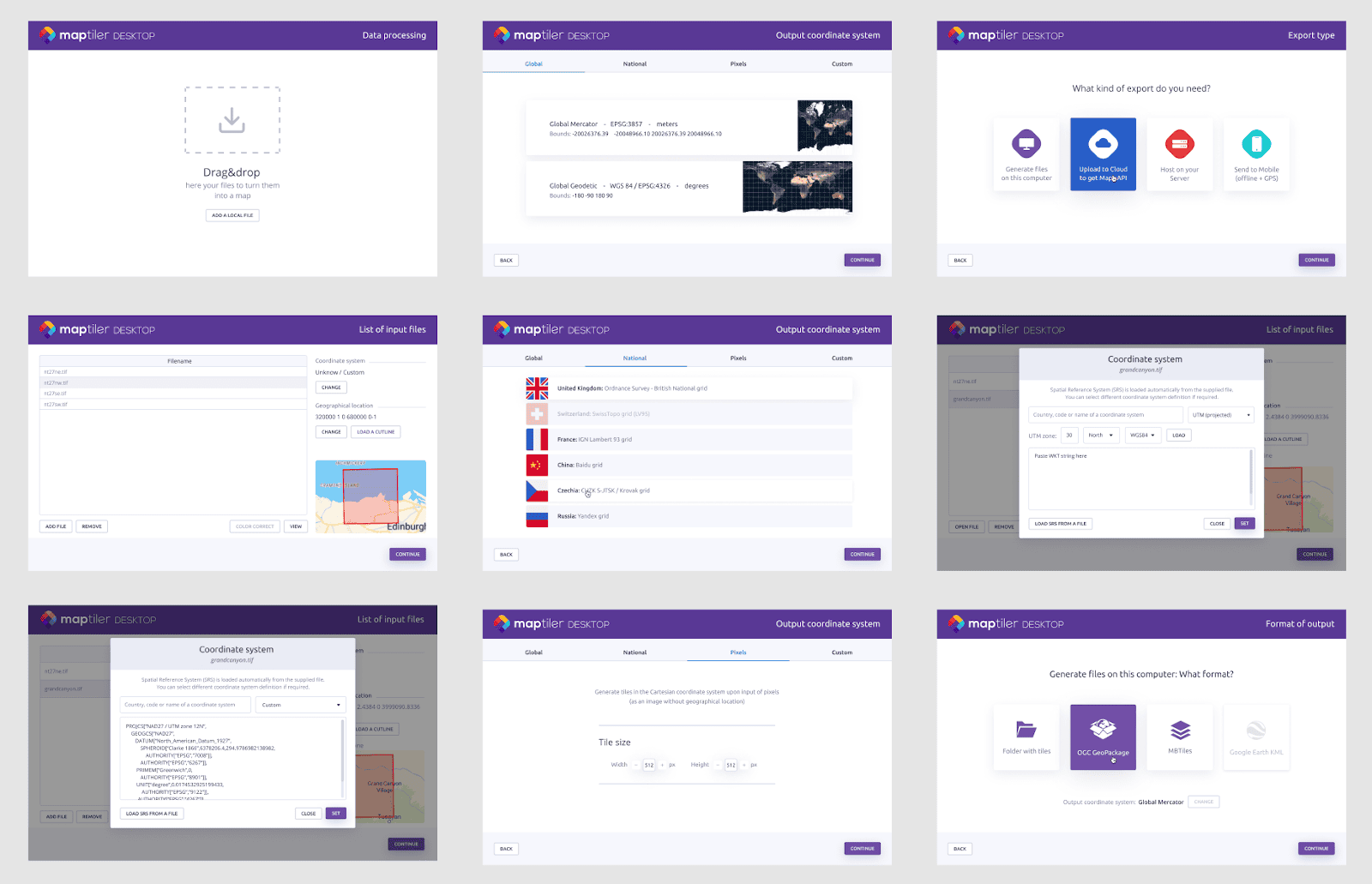 What should be in the upcoming version of MapTiler Desktop? Tell us!