Alternative coordinate systems
Process and upload map data in custom coordinate systems into our reliable global infrastructure.
Get API endpoints for use in JavaScript libraries or WMTS services for GIS software.
Alternative projections for web and mobile apps
MapTiler has made it easy to break free from Web Mercator (EPSG: 3857) so you can:
Avoid conversion
... which can cause loss of precision, distortion and delay.

Share maps
...with partners or customers in their coordinate system.

Work with cadastral maps
...without warping the source material.
Work with government data
...in their mandated coordinate system.
Host your data with government maps on MapTiler servers
Upload your high-precision map data without reprojecting and losing quality. Ideal for:
- Cadastral maps
- Civil engineering plans
- Local or national infrastructure planning
- Utilities data
Your data will be served from 200 servers across 5 continents.
High-speed, high-availability, reliable hosting.
MORE ABOUT INFRASTRUCTURE
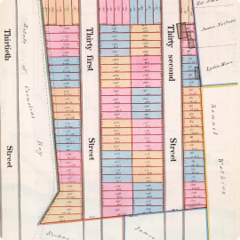
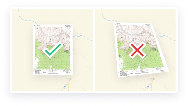
Use scanned maps without warping them
Scanned paper maps appear distorted and can be useless unless they are in their original coordinate system.
MapTiler lets you present them like the original, in the right coordinate system. They will be readable and ready to use on the web or in your application.
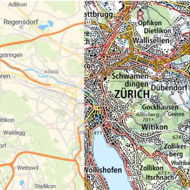
Process your data for the web in any coordinate systems
Process your raster and vector data in any coordinate system into map tiles. You can also transform your geodata into any other coordinate system.
Upload your processed data directly to our hosting service to get API endpoints for JavaScript libraries or WMTS services for GIS software.
FREE DOWNLOAD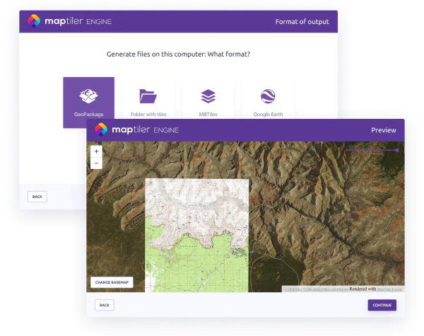
Make maps in a range of apps
Use our APIs and WMTS to make maps in your chosen coordinate system; on the web, on mobile devices, and in desktop software:


Coordinates API
Automate the transformation of raster and vector geodata between various coordinate systems.
Call API endpoints to get EPSG codes with transformation parameters in JSON format.
READ DOCUMENTATION